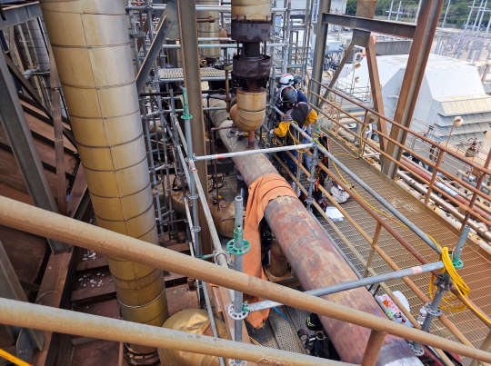
There’s a familiar pattern in older industrial facilities: what looks straightforward on paper rarely plays out that way in the field.
A piping upgrade, in theory, is just routing a new line from point A to point B. In reality, especially in brownfield environments, it becomes an exercise in navigating decades of undocumented changes, tight clearances, and legacy layouts that no longer match the drawings.
That gap between what’s documented and what actually exists is where most project risk lives. And it is where 3D laser scanning is proving its value.
The Problem with “Working Off the Drawing”
Many older facilities were built long before digital design tools became standard. Over time, modifications were made, some documented, many not. The result is a set of drawings that are directionally useful but not reliable enough for precision work.
When teams rely solely on manual field measurements and legacy documentation, the consequences tend to show up late:
- Pipe spools that don’t quite fit
- Interferences discovered during installation
- Last-minute field modifications
- Delays while crews rework solutions in place
None of these are engineering failures. They’re information failures.
Starting with Reality, Not Assumptions
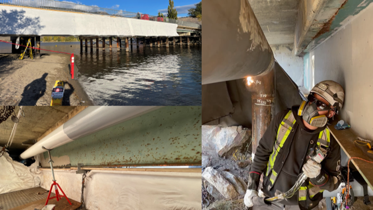
In a recent project, an Acuren client faced exactly this challenge. They needed to route a new section of piping through an existing jetty structure in a facility originally built in the 1960s. Rather than defaulting to traditional survey methods, the approach shifted early: capture the real environment first, then design within it.
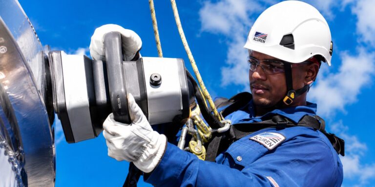
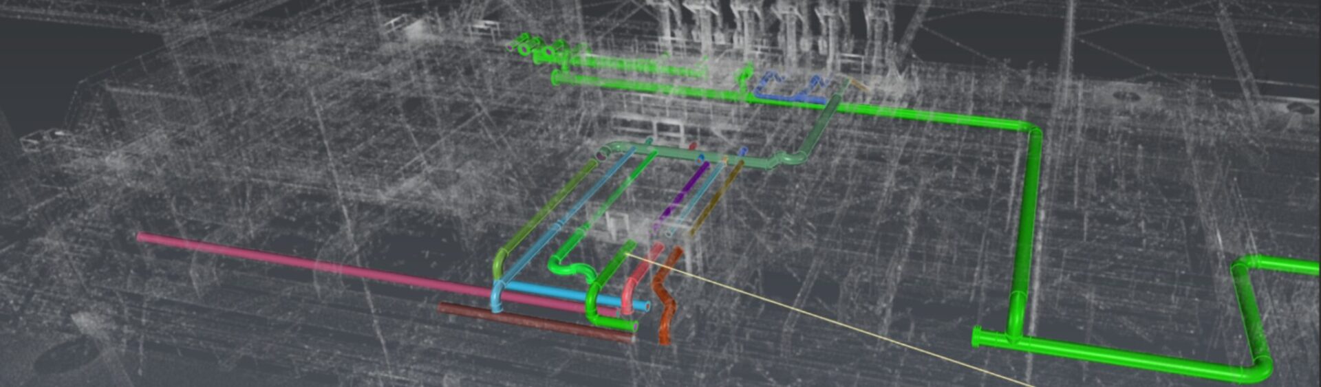
Using terrestrial laser scanning, the team collected a high-resolution point cloud of the area in a matter of hours. With proper target placement and registration, the dataset achieved millimeter-level accuracy, effectively creating a digital replica of the site. That changes the starting point of the entire design process.
Instead of asking “Will this fit?”, the team can now ask “What’s the best way to make it fit?”
From Point Cloud to Practical Design
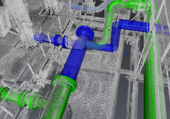
Raw scan data on its own doesn’t solve anything. The value comes from how it’s integrated into engineering workflows. In this case, the point cloud was processed and brought into design tools like AutoCAD Plant 3D, allowing the team to model proposed piping directly against actual site conditions.
That enabled a set of decisions that are typically difficult to validate early in brownfield work:
- Routing paths that maintain operator access
- Identification of clashes before fabrication
- Efficient support placement using existing structure
- Confirmation that installation is actually feasible
Clash detection, in particular, is where the benefit becomes tangible. Discovering a conflict in a model is a design adjustment. Discovering it in the field is a schedule impact.
Designing for Installation, Not Just Layout
One of the subtler advantages of working in a scanned environment is how it changes the mindset around constructability.
Support design is a good example. In traditional workflows, supports are often refined later, sometimes even in the field. Here, they were considered upfront – anchored to existing structural elements where possible, reducing fabrication scope and simplifying installation. That’s not just better design. It’s better execution planning.
Delivering More Than a Model
Another important distinction: the output wasn’t just a visualization or a digital model. The final deliverable was a set of stamped IFC (Issued for Construction) drawings, reviewed by structural and mechanical integrity engineers and ready for fabrication. This is where some scanning initiatives fall short; they stop at data capture. The real value comes when that data flows all the way through to engineered deliverables.
The Long Game: Building a Usable Digital Asset
While the immediate goal was a successful piping installation, the scan created something more durable: a reusable dataset. Captured correctly, that point cloud becomes a foundation for future work:
- Planning future modifications
- Supporting maintenance decisions
- Reducing repeated field walkdowns
- Improving communication across teams
Over time, this is how facilities move away from fragmented records and toward a more reliable digital representation of their assets.
Why This Matters for Brownfield Projects
3D laser scanning doesn’t replace engineering judgment. It improves the quality of the information that judgment is based on. In practical terms, that translates to:
- Higher confidence during design
- Fewer surprises during fabrication and installation
- Reduced reliance on field-fitting
- Better coordination across disciplines
- A more useful record for future work
For facilities operating in constrained, legacy environments, those are meaningful advantages.
Final Thought
Brownfield projects are inherently constrained—by space, by history, and by incomplete information. The question isn’t whether those constraints exist. It’s how early you identify them and how effectively you design around them.
3D laser scanning shifts that timeline forward. It allows teams to work from reality instead of approximation, reducing uncertainty before it turns into cost or delay.
For operators planning piping modifications or facility upgrades, moving from assumption to accuracy is where the real value lies. 3D laser scanning shifts your project timeline forward by allowing your team to work from reality instead of approximation before uncertainty turns into cost or delay.
Contact our engineering team today to discuss how 3D laser scanning can streamline your next project!